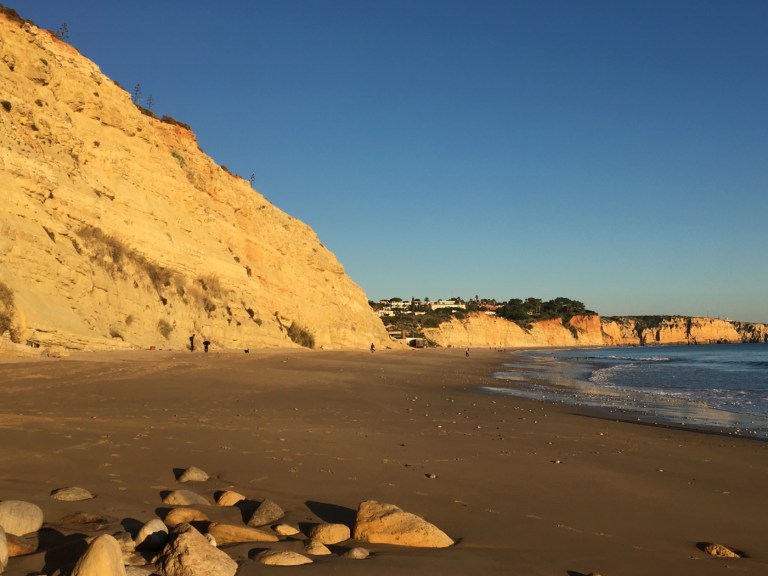
So Praia Porta de Mois is a local favorite. Though it’s further away, there’s easy parking. And it’s the best beginner surfer beach in the area (so the Internet says). I was there in the late afternoon and saw several surfers, a few moms with kids, one fisherman, and a few couples and solo folks. Of course at this time of year all beaches are pretty deserted. I mean it’s December.
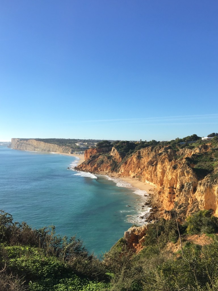
It’s actually the further beach in this photo — but remember those rocks and that point that separates the two beaches.
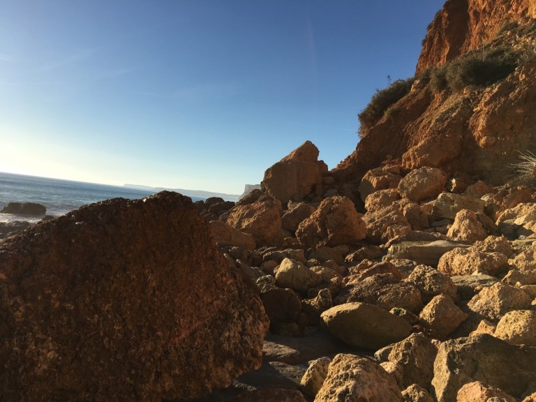
I was trying to time my arrival so I could watch the sunset from there as it pretty much faces west. I started at the Ponta da Piedade since a map showed me I could once again walk the cliffs. 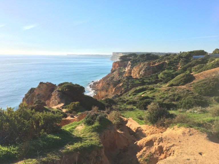 This, by the way, is kind of what it looks like when you’re walking and there’s no boardwalk set up. At one point my path stopped so I decided to try a very off-track way down to that first beach. There were actually sets of some harrowing stairs down …
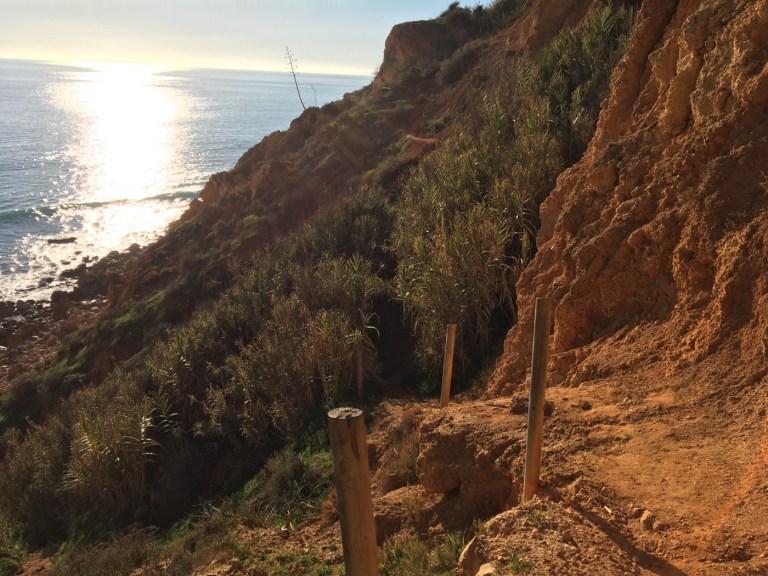
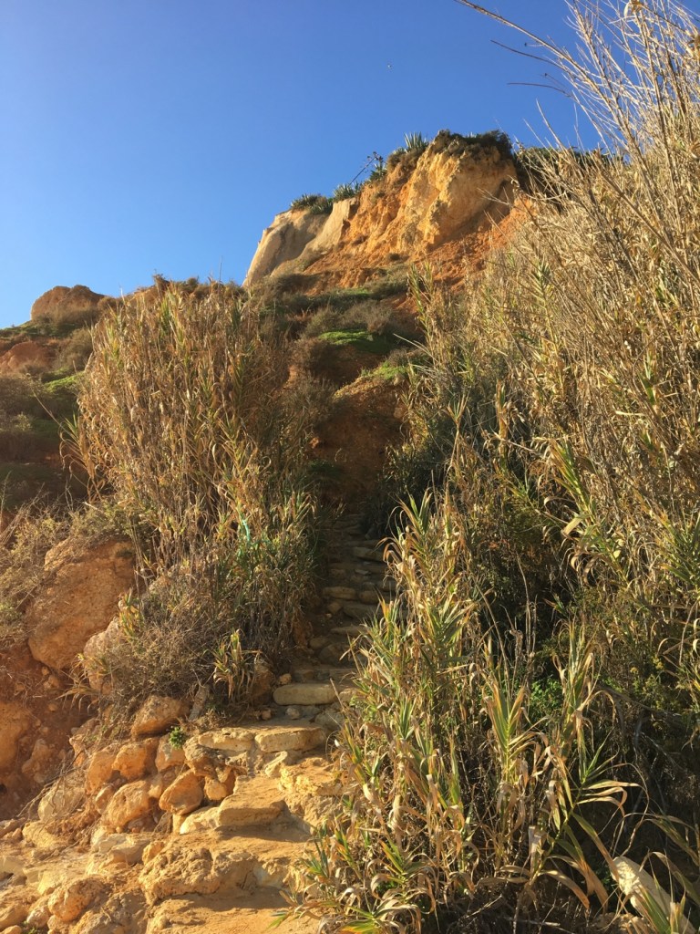
I’m not sure what possessed me but I saw some teenagers heading down and figured — if they could do it why can’t I?
Obviously I made it. But I was on the wrong side. So I had to go across a lot of rocks. In low tide it would’ve been easier to just walk in the water but I wasn’t dressed for swimming. It all ended up fine but I had a few interesting moments.
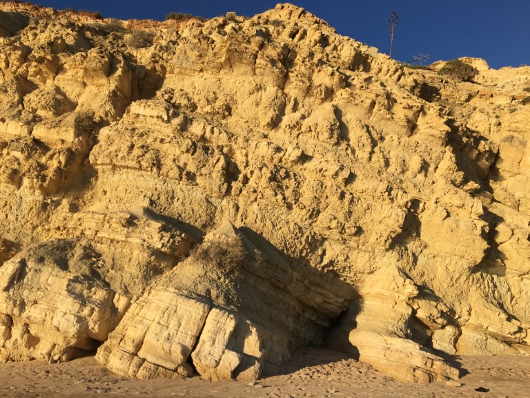
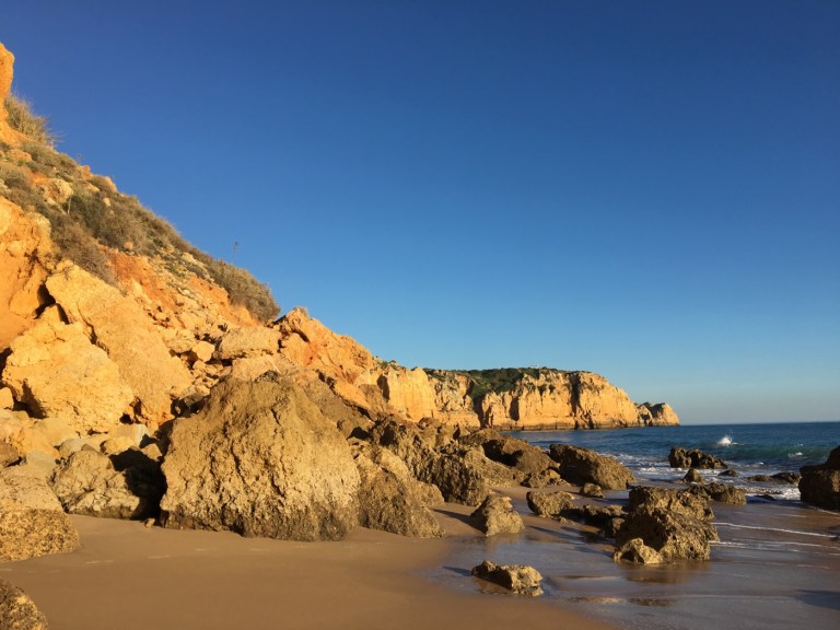 Anyway the beach is lovely and the rock formations behind it fascinating.
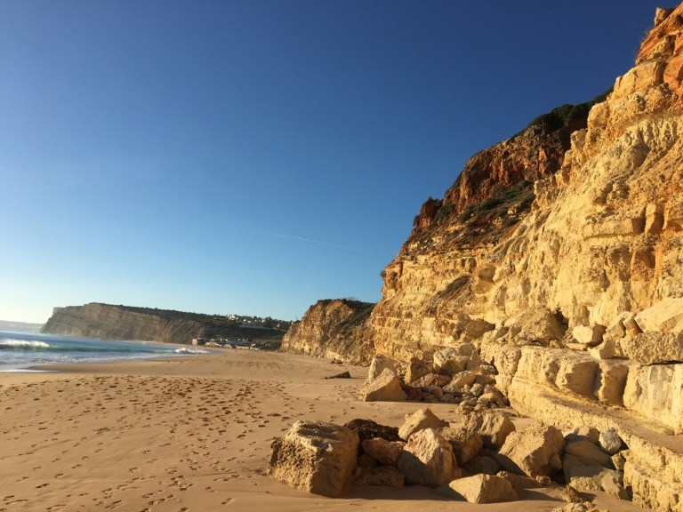
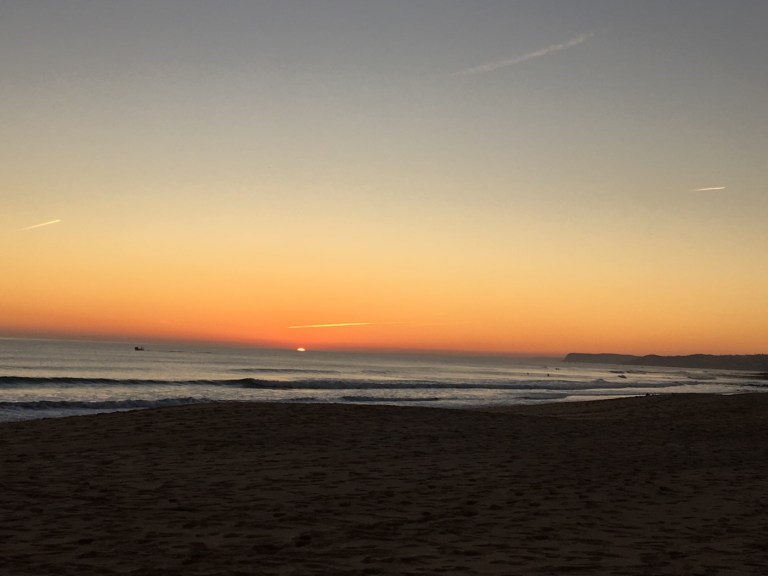
 And the sunset was worth the trip.
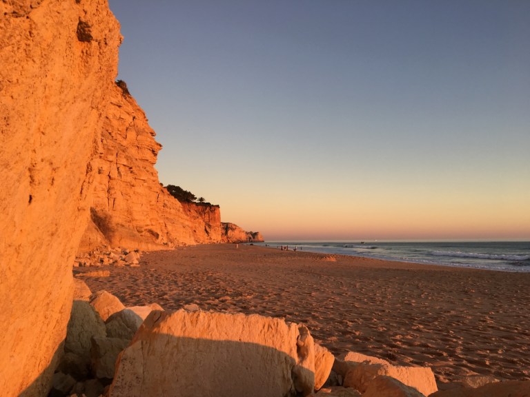
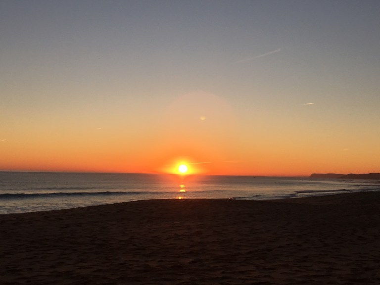
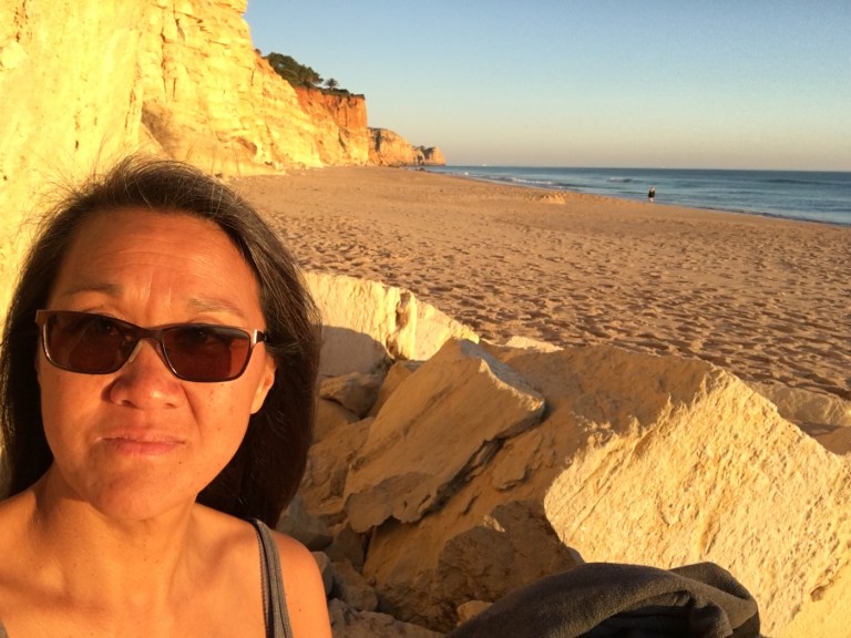
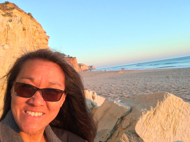
 I’m including these two photos of me (wow I hate and suck at doing selfies) because you can see how much colder it got … in the first I’d taken off my T-shirt and jacket and was down to a camisole because the sun was so warm. The minute the sun went down I had to throw everything back on and zip up! And it wasn’t windy. Just felt cold.
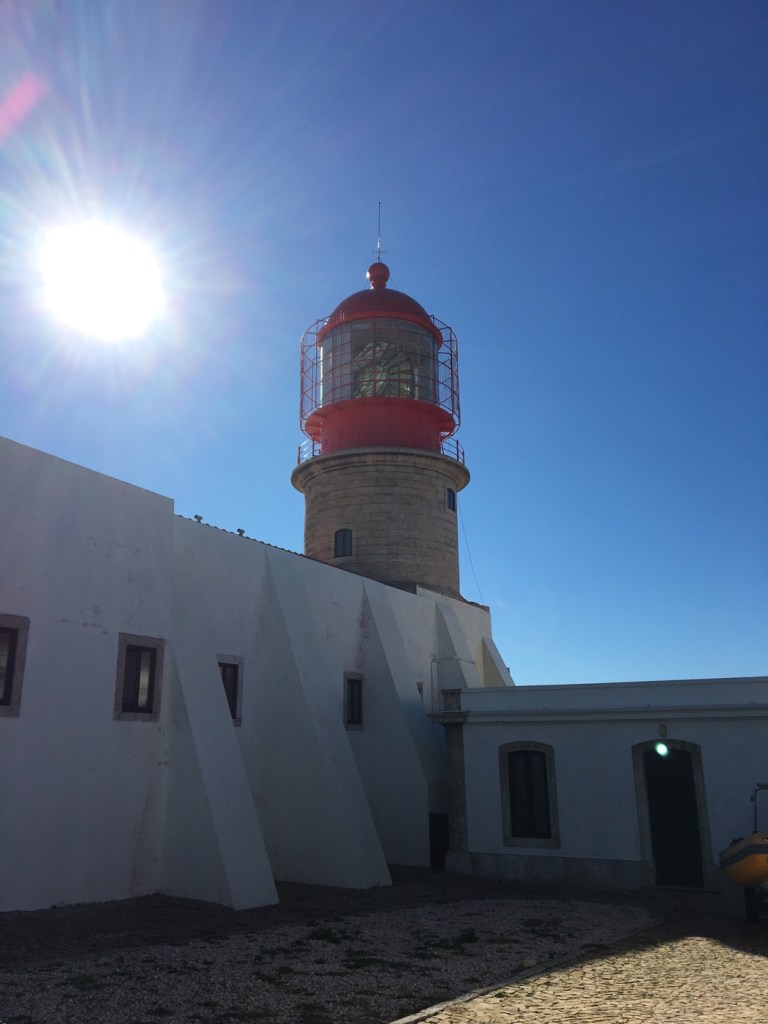
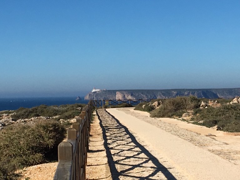
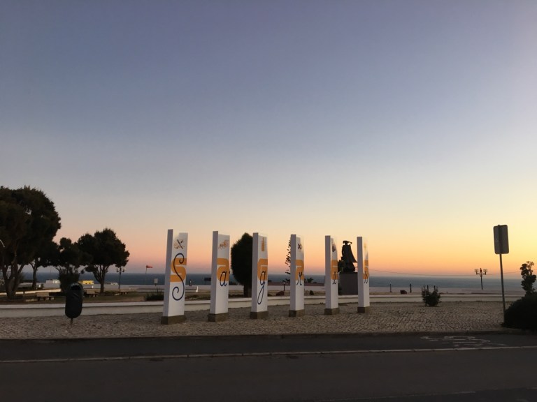
My last full day was a trip to Sagres, which means sacred in Portuguese. It’s the southwestern most town in Portugal, about 20 miles from Lagos and 40-60 minutes by bus (if you get the daily express or a local). I started at Cabo Sao Vicente which is a few miles further west and really is the southwestern most point of Portugal. It’s got the most powerful lighthouse in Portugal (visibility about 30 miles). And amazing views. (The first was obviously taken from my second stop but it’s nice to get the visual!) 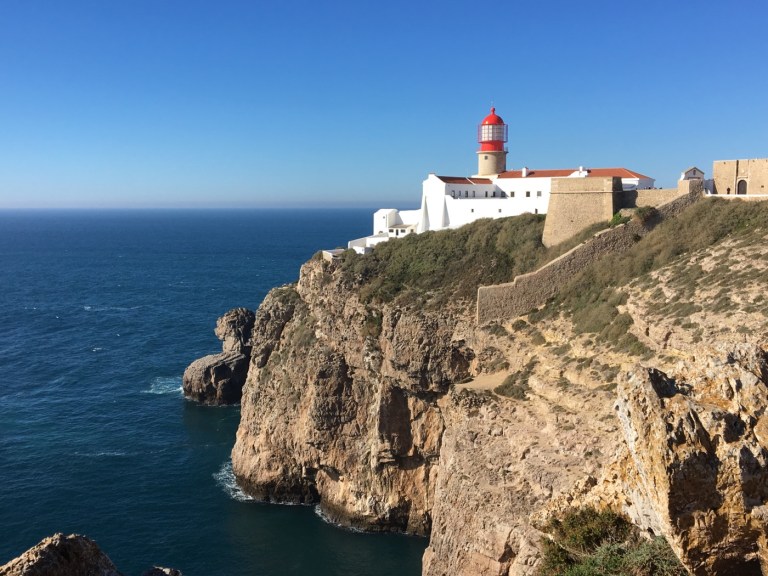
When people first came here, they thought they’d reached the end of the world. It was certainly about as far west as they could go in Europe. And that’s how it got the Sagres name. When you look out into the water you really don’t see anything else (though I’ve often thought that about Lake Michigan). 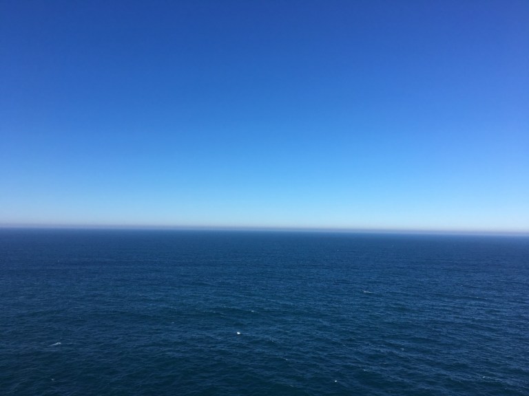
Anyway the actual big attraction in the area (other than more challenging surfing and hiking through the parks area) is an old fort. 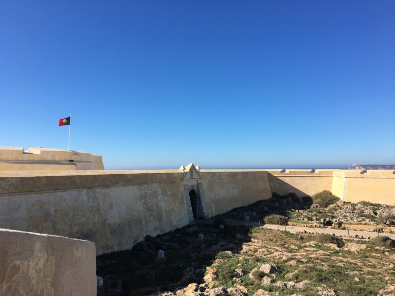
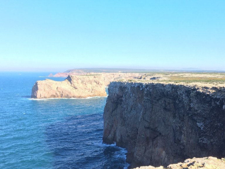
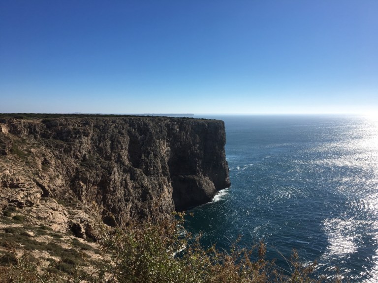
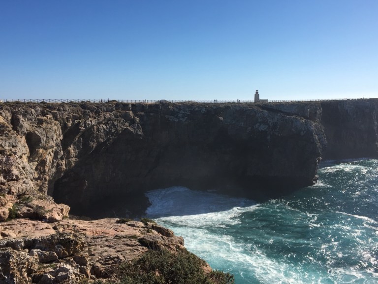
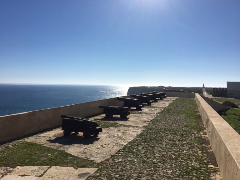
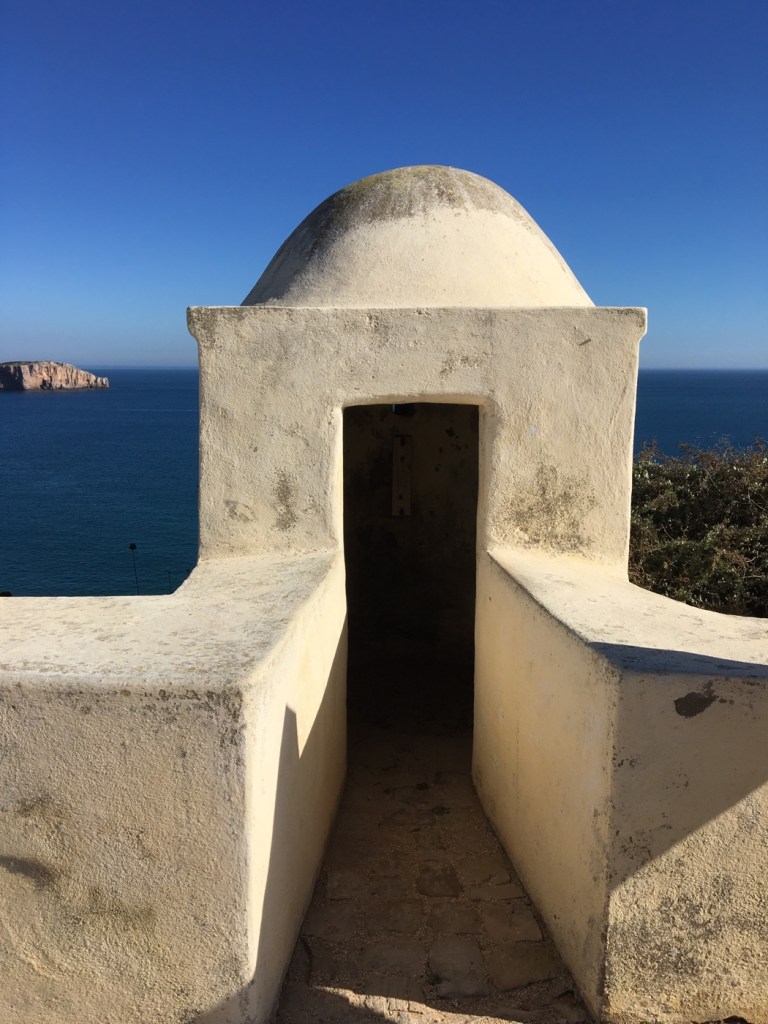
It’s actually more exciting than it sounds. It’s not just your average fort. There’s probably been some kind of fortress on this property since at least Roman times as it’s so well situated — and protected. There’s only one wall because the other three sides were sheer cliffs. 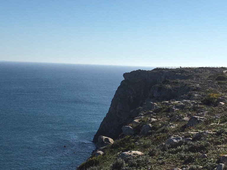 And it’s huge. Inside the wall it’s another mile to walk the perimeter of the cliff walk since it’s built on a promontory. And the views are amazing — better than at the lighthouse. It’s where I took the lighthouse shot. And these.
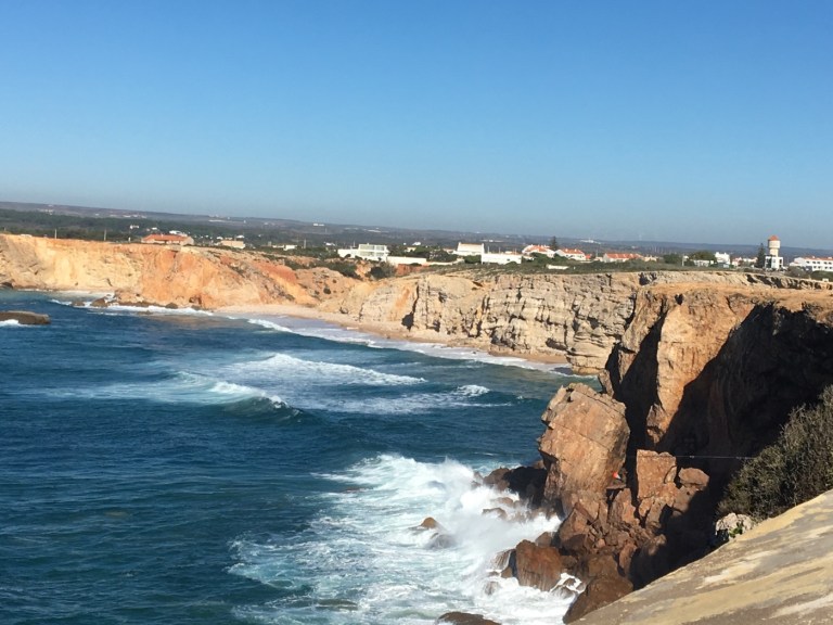
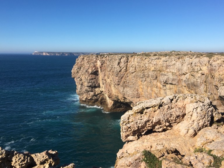
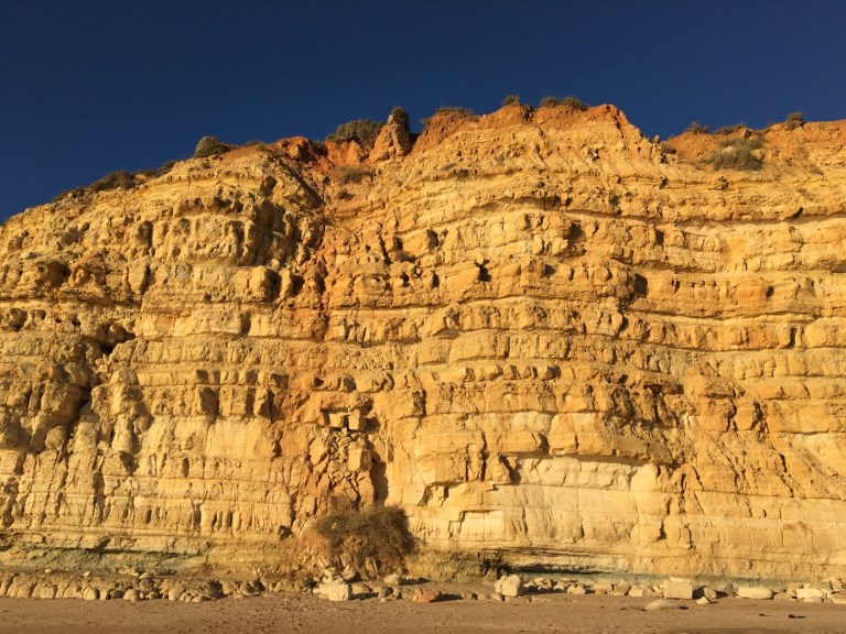
I’m still amazed all these cliffs were formed by the constant crashing and battering of the ocean on the rocks. I read in one place they’re sandstone and in another they’re limestone. I think the ochre-colored ones are sandstone but these more gray ones are limestone.
Back to the fort. It’s an obvious location for a lookout point and many rulers built a fortress here. But it was fortified (tee hee) often. 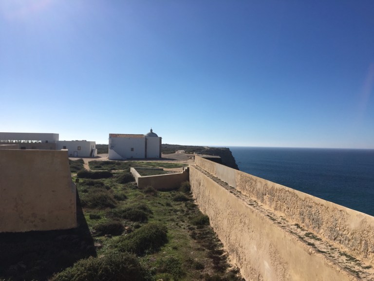
 Most famously by “Henry the Navigator” — so called (after his death) because under him, the Age of Discoveries flourished. And in fact he created (in the 1490s) on this site, a school for navigation that would influence the rest of the world.
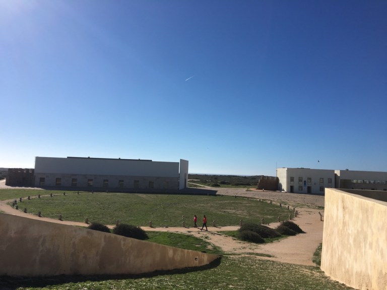
This was recently discovered — it’s either a giant compass that was used by the school in training or possibly a huge sundial. The historians don’t yet know but it’s intriguing nonetheless.
They’ve done a nice job curating this site though the guidebooks warn you that it could be boring. Not that they recreated the missing walls or whatever was lost in the earthquake. But they have well marked paths for walking the perimeter. And lots of signs about the various artillery-related rooms that had been there. And also lots of signs about local flora and fauna (birds use the area as a stopping point in their migration to Africa). And the aforementioned views.
Oh and of course the obligatory warning signs — here put up next to the pass through to the cliff?! Oh I also saw several local fishermen. It kinda freaked me out — they’re so high up their lines have to be incredibly long. And if they hook a big one, couldn’t they get dragged off?! It looked scary to me.
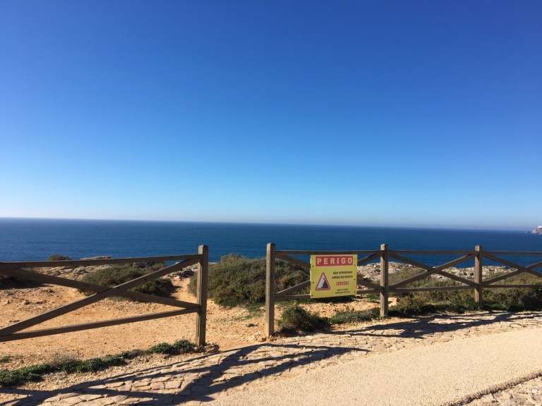
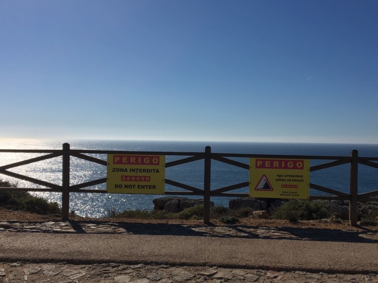
Um, two signs?! You don’t have to tell me twice! Though of course I saw people beyond all signs. I also saw several little markers with people’s names on it that I presume are for those who took a step too far??!! It’s a pity but I think I’m with the Portuguese on their attitude that if you take the risk, you take the consequence.
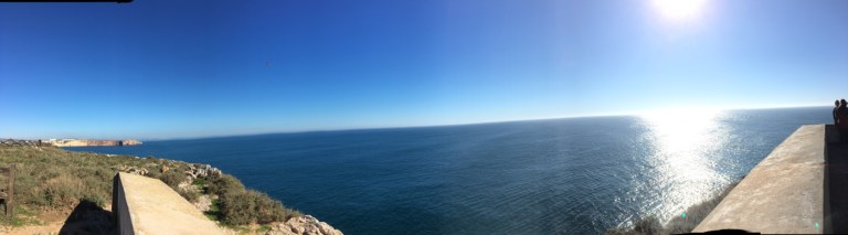
Oh well. On pleasanter topics. Before I left the fort I tried to take a panorama though I’m not great at it … but really the water is everywhere. I guess that’s why they thought it the end of the world.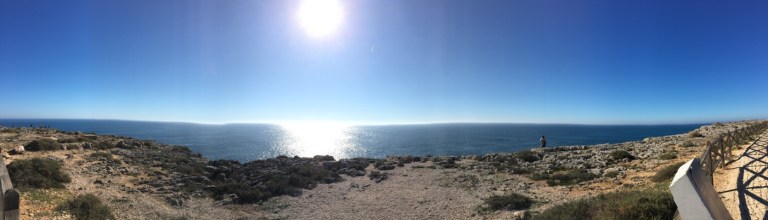
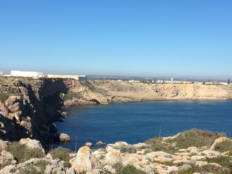
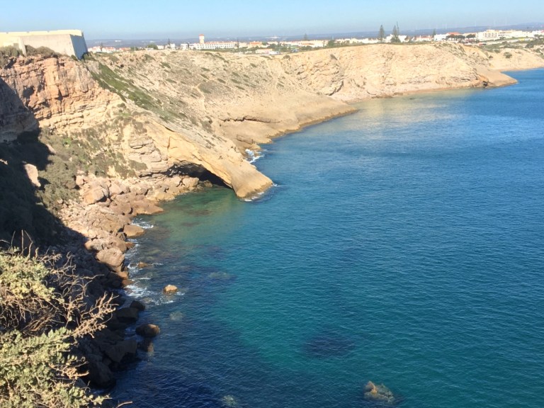
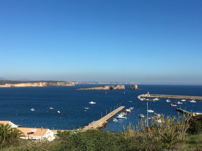
After the fort I headed east to the supposedly protected area that’s the Sagres port. Meantime, may be coincidental, but the wind picked up there (oh it was also very windy at the lighthouse).
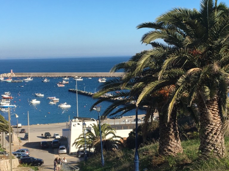
I stopped for a late lunch at a fancy place overlooking the dock. This was the view from my terrace seat. 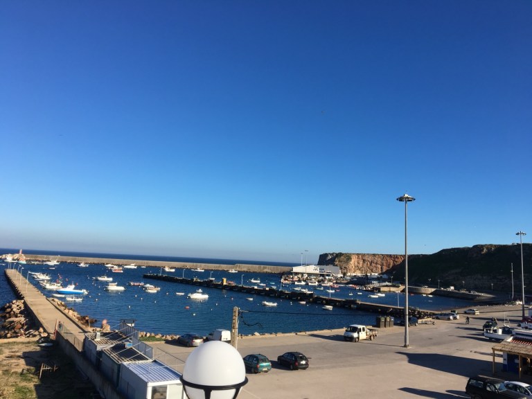
Very pleasant and I had an Algarve traditional dish of cataplana. A fish stew in a traditional pot which was Arabic in origin. Yummy.
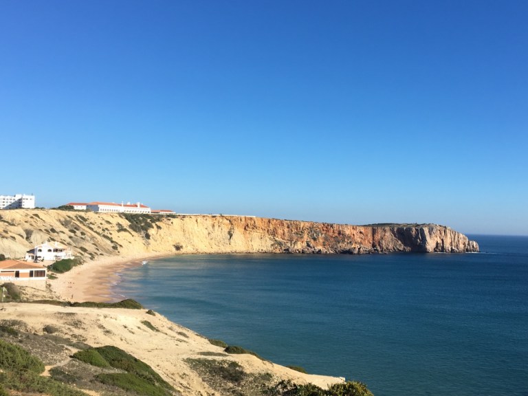
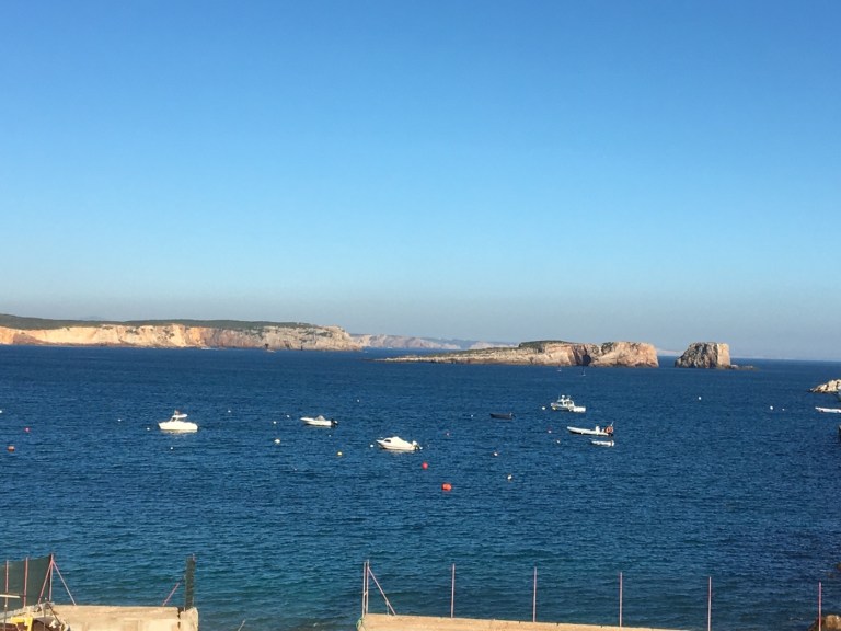
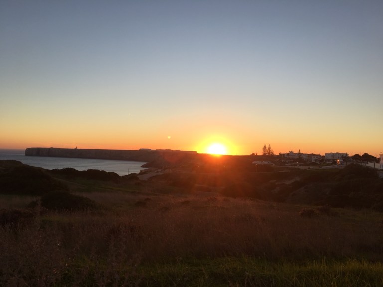
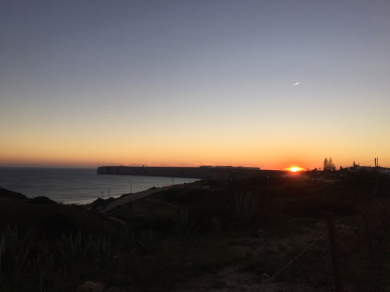
Anyway I had to catch a 530 bus back to Lagos or wait another hour so I took a few early sunset photos. (Really a pity I wasn’t at the fort then as it has straight west views. The promontory in the way of the sun is actually the fort.) Still not bad. 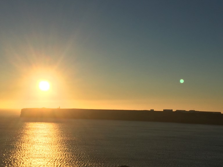
 That’s pretty much it for Lagos and the Algarve. Although here’s a final shot of a placa not far from my Airbnb which held the old slave market. Ashamedly, this may have been the first place in Europe to bring in slaves from West Africa for trade. They’ve put in a museum to tell the history — though I never made it when they were open, it sounds like the stories and artefacts are pretty powerful.
  And that’s it.
I’m on a bus (with good WiFi — actually quite a nice coach, though he just announced we don’t have a toilet onboard) to Seville, where I’ll change buses to Malaga, Spain. I’m going from Algarve to Andalusia.
Troy will be flying in the next day so I’m going to rent a car and we’ll see the Moorish sights on the Spanish side! I’ve been in Portugal about a month and though I’ve barely figured out anything about the language I’m sure I’ll miss the hospitality. The security. And the prices (I hear Spain is pricier but southern Spain shouldn’t be too bad).
Adeus Portugal!

Since I share your fear of heights, those cliffs are scaring me just from the photos. I can’t believe you braved the climb, but the views are drop-dead gorgeous. Hope you guys are enjoying Spain.
LikeLike
I’m motivated when it’s an amazing grotto and sea view! And yes Spain is going very well!!
LikeLike